Wednesday, November 16, 2011

1 Mountain, 1 Lump, and 1 Peak- Chief Mountain, Papoose Mountain(Lump), and Squaw Peak

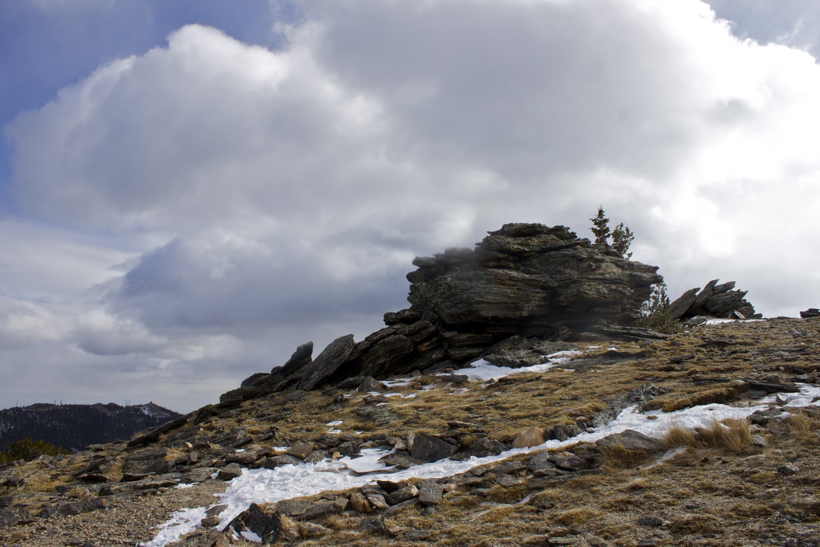
Chief Mountain, Papoose Mountain(the lump), and Squaw Peak, are three of the lesser peaks in the Indian Peaks Wilderness(IPW). All three are tree covered, however Chief and Squaw have rocky outcrops at their tops. Here is a map of all three!

View from the side of Chief Mountain.
 This last Sunday, I went on another group snowshoe with the Colorado Mountain Club(CMC), it was an unusual day for weather. At 7:30, when we left the Denver area, the sun was rising, and there were some clouds in the sky, when we arrived at the trailhead it was grey, halfway up the trail the wind picked up, and it began to snow. The trail started on road, then veered off into a foot and a half of snow, it was packed down-- there were  few skiers up ahead of us. The Chief Mountain trail headed up onto the side of the peak, and through a few clearings. Once we cleared tree line, the wind became relentless, stinging my face with snow crystals. I removed my snowshoes, and followed the snow-slicked rocky trail to the summit of the peak.


The final scramble was slippery, but fun. The wind nearly swept me from atop the summit, and it had begun to snow.
View from the Summit of Chief Mountain!
We hiked back down the trail and up and over the "lump" known as Papoose, and down the back side which was FANTASTIC powder! Then we hiked up the road to the summit of Squaw Peak and back to the car. All in all, a good first foray into the Indian Peaks Wilderness. 

Tuesday, November 15, 2011

Grizzled at Grizzly Gulch

I was supposed to climb Argentine Peak, however the group I went hiking/snowshoeing with changed the destination halfway there to Grizzly Gulch.  I was rather disappointed, however getting blown off of a ridge by high winds didn't suit me either.

From the cars, we hiked up a steep unplowed road to the trailhead, where we strapped on our snowshoes and slogged on. The trail was strewn with disintegrating cabins, abandoned mine shafts, and awkward stream crossings.

We veered off trail about two miles from the cars onto a heavily wooded hillside, that dipped down into a brook. Now this was the first time that I navigated a stream crossing on snowshoes, it was a swift stream, and stepping onto rocks with big "yeti crampons" on my feet was awkward! There was a few times throughout the day that I feared that I'd end up in the water, I'm not the most graceful of women. 
We found the trail and continued through a few clearings, the wind was howling through the trees, kicking up snow and nearly obscuring the scenery. 
On the left was Kelso Mountain, and Torrey's Peak, to the right was either Bard or Baker Mountains, and straight ahead Grizzly Peak loomed in the distance, a dark monolith. 
Kelso Mountain and Torrey's Peak

To the Right.

Grizzly Peak.
On the way up the trail, I was having my tushy handed to me by an 84 year old gentleman, on the way down, I was in the front of the pack. It really hit me that I need to be training WAY harder than I have been in order to become a strong mountaineer. 

Snowshoeing is great training, I find it to be far better exercise than hiking-- if I had been hiking this trail I wouldn't have been so tired.

I was rather disappointed that we didn't climb Argentine Peak, however I was able to see a different side of Grizzly Peak, and had a good introduction to winter!


Saturday, November 12, 2011

Doing things in Du-rango!

Five days after I returned from New England, my brother came out to visit. We planned a three day trip to Durango, arriving on Monday night, and leaving early Wednesday morning to drive back and have dinner with a friend.

Though I usually do not show photos from the drive, they are so spectacular that this post will include some of them. The drive to Durango took about 6-7 hours from Denver, and we passed through some of the most lovely scenery! Snowcapped ranges,  unusual rock formations, and a cascading waterfall!


Driving through Fairplay and South Park County.
Chaffee County, Co.-- more 14ers than any other county in Colorado.

Treasure Falls-- Over the summit of Wolf Creek Pass.
The next morning, after a crazy halloween evening, we drove up the Colorado Trail a ways, for a lovely view of the peaks.
View into the Las Animas valley
Peaks to the west!
View towards Durango.

Later we took a hike up an area called "the hog back", which is an interesting place geologically speaking, I found a small fern fossil near the top! The trail began in a wooded area, with many desiccated streams, and the distinct clink of mountain bike gears. The first section of the trail was not exceedingly steep, however once on the ridge you could fall for hundreds of feet!
Half way up the ridge. 
My feet, and the drop!

The trail was very dry, and towards the top quite difficult to maneuver. I felt my feet slipping, and slid a few feet with nothing to grab, luckily I was able to dig my toes into the dust! Once we reached the terminus, the view was incredible!


We took a photo for our parents, as this was the first time since I was 9 and he was 7, that we were together in Durango!


After the hogback, we walked up Horse Gulch, a lovely area surrounded by beautiful rock formations, and a large meadow with two ridges jutting from the far-side.


The weather was gorgeous, and I found Durango to be one of the coolest places I've ever had the pleasure of spending time! If i were offered a job there tomorrow, I would be out of the city so fast, even if it meant living in my tent for a few weeks :).

It was awesome to spend some time with my brother, despite the fact I was unable to challenge myself in the backcountry, however next time...I'll be climbing some larger peaks!

Tuesday, November 8, 2011

Entering the Bearsden

I spent this last week visiting my family in Massachusetts. For the first time in over a year I gazed upon familiar terrain, without unknown risks!

Most of the week was cold, grey, and rainy- typical New England weather. I had decided that I was going to spend time outside regardless of the weather. My mother wanted to wander around the area she grew up near, called "Bearsden Conservation Area" located in Athol, MA.

It was strange for me to go hiking in an area I was very familiar with, it had been over a year since I had returned. Driving up to the empty parking lot made me miss the few cars always present at any trailhead in Colorado, no matter what day of the week!

We headed out into the dreary, damp New England woods, with no specific destination. There was a very strong chance of showers, so I took the precaution of bringing raingear, and a plastic garbage bag for my camera.

The smell of the woods was very familiar yet strange, I spent last fall hiking all over Colorado, and let me tell you the woods smell very different in the fall. The ground was very spongy,
and sunk with each step, as we trekked to the top of Bemis Hill.

My mother told me that this hill used to be covered in black walnut trees when she was a kid. She grew up playing in these woods with her childhood neighbor Ricky. This hike, though short, was a walk down memory lane for her, and I heard some interesting stories. She recounted the time they played Daniel Boone and borrowed a cow from Ricky's father's farm. They penned up the poor cow, and then as children usually do--got distracted and forgot she was up there. Ricky's father heard the cow mooing up in the woods, and was quite angry with them.

After reaching the summit of the hill, we went off trail down the backside of hill towards Millers River, eventually finding ourselves at the Oxbow. I had never seen the river so flooded, apparently there has been record rainfall this year.
We walked along the edge of the river for a ways, then crossed over a stream...or rather I crossed the stream... my mom took off her shoes and waded through.

Across the stream, we found a small fishing hut.

We sat there for a few moments then followed the 'old stage coach' road back to the main trail, and the parking lot. About 5 mins from the shack it began to pour, luckily we brought the raingear.
I wish I had been able to do more hiking while visiting, or that the weather would have complied. It was great to visit New England, see my friends and family, remember childhood, and enjoy the smell of the damp autumnal woods.

Monday, October 24, 2011

1st Flatiron- Flattening.

During the months on September and October, I decided to take the Colorado Mountain Club's- Basic Rock Climbing School with the Boulder, CO. Group. At the first lecture the let us choose our own group, a decision not usually allowed in the Denver Group-- I signed up for the Ice Climbing School Director's group. The first field trips were fun, and everyone was very nice-- however the final graduate climb- a six pitch route up the 1st Flatiron, was amazing!

There were six of us, and we combined two routes- Bakers and Fandango to create Baker-dango. The hike was probably 3/4 mile from Chautauqua Park in Boulder, Co.- and past the standard route. I was in a group with two other guys, and the last climber in the line. I was responsible for cleaning anchors, however I ended up cleaning gear on two of the pitches-- there were six and a half pitches total. 

Here is the view from the beginning of the route.

Here is me before I began climbing! Bright-eyed and ready to go!
The first pitch was easy to follow, and a simple climb.


 The second pitch, was slightly more tricky, however I ended up sticking to the crack, the heights started to get to me. The view from the second belay station was gorgeous!


 Currently-face climbs scare me- I need to get over that fear- but I need to practice, which requires a belayer!-- The third pitch was simple, however the belay station required a hanging belay. I was clipped to the anchor as well as a piton, because I was quite high up by this point, and needed to clean the anchor, which required unclipping. 
The  edge of the 1st Flatiron, and the 2nd in the background.
Once at the beginning of the fourth or fifth pitch, we had a moment to rest and look at the gorgeous expanse of Rock Mountain National Park, way in the distance. Longs' peak sticks up like a tower at the northern most point.
We were all attached to the same anchor, and had a group climbing over the top of us.
Ian was the second person in our group, and Clare with the massive tangle of ropes, was the lead climber for the other group. 

I wasn't fond of the first half of the next pitch, it required me to edge out around a lip, and up a sheer rock face. Now I know, I've already mentioned my fear of heights, but it certainly took me a good half an hour to get up the nerve to climb the first half of that pitch, I was terrified!!! After some coaxing by Clare, I was able to complete the pitch, and the next two without a hitch. I had finally made it to the summit of the 1st flatiron.

We then had to repel off the back to the safety of the ground, Ian was the first to repel, however it was an incredibly windy day, and the rope got stuck. Ian was stranded for a good 10 mins. Once he was safely on the ground, it was my turn- the lead climber-- for some reason decided he wanted to set up my belay device. He set it up backwards, I was mildly annoyed...however it was made worse by the screw-gate of my carabiner jamming. It took another 15 mins for us to finally get the 'biner freed up, and this time I set up the device correctly, and repelled off the back. I followed the line of the rope, not knowing that the wind had carried it way to the right. All of a sudden I heard a loud "SNAP", the rope had been on the edge of a small lip, and broke free sending me penduluming 30 feet out from the rock. I screamed "SHITTTTTTTTTT", threw my feet way out in front of me, and after slamming into the rock, I was able to complete the repel, landing safely on the ground.

Upon completing my first multi-pitch climb, I've come to the determination that I need more work before I attempt another such climb. I want to complete a lot more training climbs, maybe some smaller multi-pitch, however I wouldn't trade the experience for anything! It was an amazing place to be, and everytime I look up there, I know I've climbed it! I just cannot wait until I am lead climbing something so fantastic! 

Fall in the Southwest...

So, I decided to take a short trip to Santa Fe, NM., to enjoy some of the hiking and go to Trader Joe's.

On sunday morning, I went for a hike in the Pecos Wilderness about 15 miles outside of Santa Fe proper, beginning at the Santa Fe Ski Basin. The drive from town was beautiful, adobe houses everywhere, red sand, and desert plants. As you exit one ecosystem, you enter a forested environment, with great stands of pine and golden aspen.
I began my hike at the Windsor Trailhead, which was surprisingly deserted for a Sunday, though I'm used to the crowds in Colorado.
The trail begins with a moderately steep switchback section, after hiking for about 10 mins, it flattens out, and meanders to the boundary of the Pecos Wilderness.

The trail was well shaded, and  the quality of light would change as you passed through golden aspen groves, the smell of decaying leaves sweetening the air. The trail veers off to the right, with may tributaries, it's rather difficult to determine which trail to follow. I decided to take the trail following the brook, as it lead to my destination. 


 The winding trail followed the book through the woods, steeply, next to large rock walls with fields of talus.


The lake was surrounded by rock walls, and tall conifers- the perfect alpine lake.


I met a nice couple at the top, who were nice enough to take a photo for me. 


The hike was a cathartic reminder of why I love the mountains- golden aspen, sunshine, tall trees, and beautiful wilderness. 

Sunday, September 11, 2011

Mt. Sniktau


I decided that today was a fantastic day to go hiking, however I had not gotten up early enough for one of my more rigorous adventures. Earlier this summer I was supposed to go up Mt. Sniktau with a group of folk from the CMC, however I had been ill and unable to attend...So today seemed like a lovely time to go! It was a 4 mile round trip with approximately 2200 ft of climb, off of Loveland Pass.

The hike was very easy, but it was quite windy and cold up there! There was a snowstorm up on Torrey's and Gray's Peaks!
There was a lovely view of the Gore Range, as well as the Citadel on this trip! The Citaldel is on my short list!

I began my hike at 11am, and finished at 2pm-- there were some very nice folk from North Carolina that engaged me in conversation!
Next week....Cupid to Grizzly Peak, or the Citaldel!