Sunday, September 11, 2011

Mt. Sniktau


I decided that today was a fantastic day to go hiking, however I had not gotten up early enough for one of my more rigorous adventures. Earlier this summer I was supposed to go up Mt. Sniktau with a group of folk from the CMC, however I had been ill and unable to attend...So today seemed like a lovely time to go! It was a 4 mile round trip with approximately 2200 ft of climb, off of Loveland Pass.

The hike was very easy, but it was quite windy and cold up there! There was a snowstorm up on Torrey's and Gray's Peaks!
There was a lovely view of the Gore Range, as well as the Citadel on this trip! The Citaldel is on my short list!

I began my hike at 11am, and finished at 2pm-- there were some very nice folk from North Carolina that engaged me in conversation!
Next week....Cupid to Grizzly Peak, or the Citaldel!

Thursday, September 8, 2011

Emergency Backpacking Trip!

So, I was supposed to go climbing on Sunday August 28, 2011, with my best friend(visiting from MA), and my usual leader, however on the way to meet him in Denver...we were in a car accident, 200 yards from our destination. It was a very stressful morning, and needless to say I needed to blow off some steam. 

Later in the afternoon my dear friend Tiffany consented to drive us up to Guanella Pass, and drop us off until Tuesday. We packed our gear quickly, and Tiffany picked us up for our trip. Our plan was to backpack a ways in from the summit of the Pass, set up camp, and get up early to climb the peak. 

We arrived at the pass around 7pm, and thank the amazing Tiffany millions of times for driving us way up there.
Upon arrival!
Tiffany and I at the trailhead!
Tess ready for her first "backpacking" trip/14er.
This is where we are heading!
An amazing view of the opposing side of the Sawtooth after sunset.
We hiked probably a half-mile and were unable to find the trailhead in the dark, so we finally found a spot in the middle of the willows, more than 100 ft off the trail, and set up camp. It was dark by this time, and we crawled into our sleeping bags, and set an alarm for 4am.... we ended up sleeping till 6:30. When we got up, we gathered gear, ate breakfast, and prepared for the hike. 

There were dark clouds on the horizon, and I was hesitant to continue on with the hike.

However, they stayed low, and enveloped the landscape.


We hiked above tree line, and continued up the trail. The valley below was covered with clouds, and it became incredibly cold and windy. By the time we hit the final scramble to the top, the clouds were racing up and over the ridge. It was amazing, to see nothing, then see everything in a matter of moments! I was able to see the other side of the ridge, which on one side held Frozen Lake- a trip I've yet to take, and the other, Abyss Lake, where I've already been. 


Abyss Lake
Frozen Lake.

The Final ridge was difficult to see with the clouds, so I ended up scrambling over large boulders to the summit, my friend took a slightly different route.
This is the view over the sawtooth.

Not all 14ers have a Geological Survey Marker, however Bierstadt is one of them, at 14,060Ft.
From the Summit, 14er #2.
A view from the summit.

The hike down was relatively uneventful, and we stopped at the stream to refill water, and have a snack. 


We sat in a small clearing filled with gorgeous flowers!
Tess was very happy we were able to do it!

We made it back to the tent by around 2:30 in the afternoon, and decided to eat some lunch.

After sitting in the tent for another half an hour, we determined that we were bored, and would like to change locations. This was a problem, there was no cellphone service in which to notify our driver, so we decided it better to pack up and backpack the 11 miles down to Georgetown, CO. As we were packing up, we saw an amazing phenomenon-- it began to mist down near the lake, and we saw a low hanging rainbow! It was below us!
Certainly one of the coolest things I've ever seen!

We packed up and began the hike, managing to txt our driver, and she was able to come get us around 7 at night. We hiked 8 miles before she picked us up, and saw a neat electric station!


Altogether it was an amazing trip, and certainly worth the emergency status!  After such a stressful few days, it was nice to get out and enjoy the wilderness again. As for my best friend, one of her big goals coming here for a visit was to summit a 14er, and she was able to do so! 


Stewardship of Mount Yale

From August 4-7, I volunteered for a stewardship project on the side of Mount Yale in the Collegiate Peaks Wilderness. This trip required backpacking experience, which I had collected on my last two trips, so I felt well prepared.

I had to leave a day later than the rest of the women due to a school obligation. I arrived at the trailhead outside of Buena Vista around 9am, and gathered my gear and set out on the trail.
They had sent me a section of a USGS quad map, with the location of the base camp. I came prepared with my compass, and the section of the map printed. As I headed up the trail, I kept my eye on features in the landscape, and confirmed the orientation of the map, and after 2 hours of walking up and down a section of the trail where it appeared the base camp was, I decided to go off-trail and follow the creek, because the camp was on the creek at 11,200 ft.  Once i reached the location delineated on the map here is what I saw:
  Beautiful alpine meadow...but no camp, so I hiked up and down Browns Pass trail, looking, and finally gave up and went back down the trail to the Mt. Yale junction, and sat down, figuring they would need to come down eventually.  After sitting down for a few minutes, someone came down the trail, and told me that the camp was up the Yale trail. So I hiked up about a mile or so, and finally located the camp, apparently they had marked the Base camp on the wrong creek. It was on Denny Creek, not Delaney-- I had followed the directions correctly, they had made a mistake. So a hike that should have been 2 miles, ended up being 7.

The camp was in a lovely stand of pine trees
near the brook. I set my tent up, and brought my food to the kitchen area. We went to bed at 7:30, and awoke the next morning at 4:30 for breakfast.

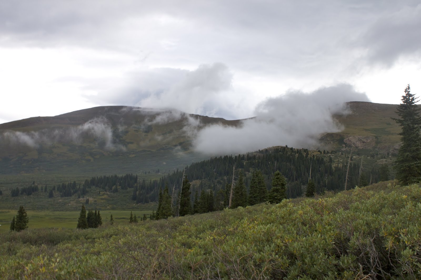
The first section of the hike was conducted in the dark, through dense forest, until you reached a steep switchback section that looks out onto the valley below.

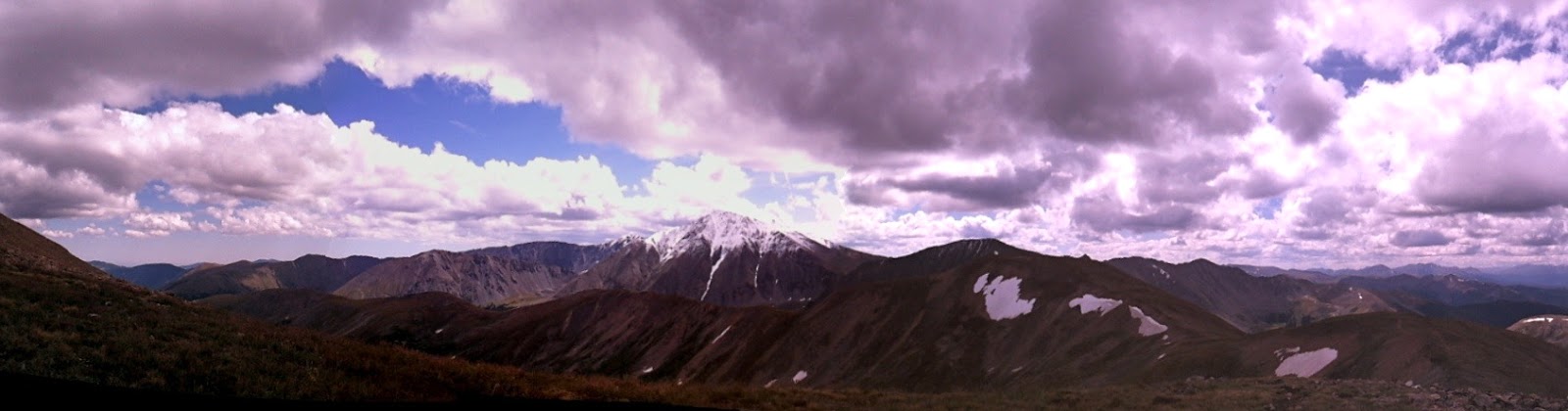
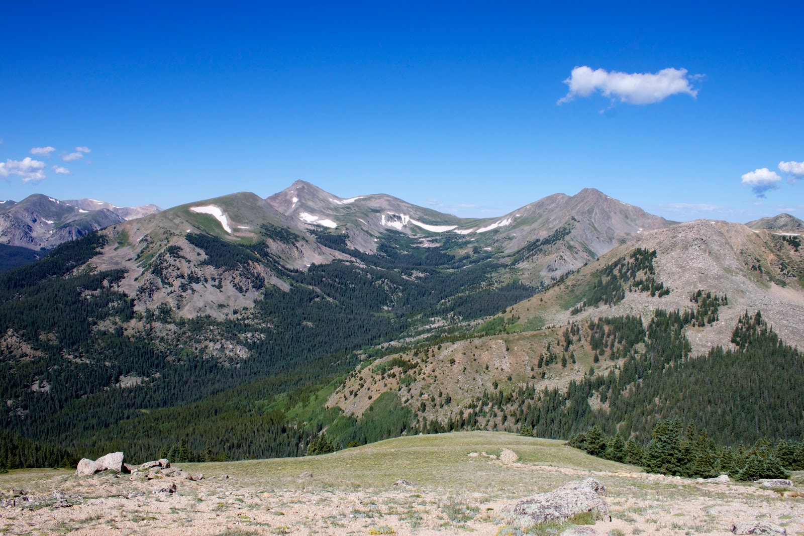
Once above treeline, we departed from the trail, and carried the tools from the prior days work, to the worksite. The scenery was amazing; we were working to fill in an old trail, and repopulate the native grasses.


I worked with the group for 6 hours, transplanting native grasses from the alpine tundra, into the old trail. It was quite chilly up there in the morning, and we were berated by strong winds, but it was an amazing experience!
While working, we were required to wear hardhats...
At 11:30, I decided to make a break for the summit, as it had been looming over us all morning, calling my name. This would be my first  14er, and I was already half way there....so why not?

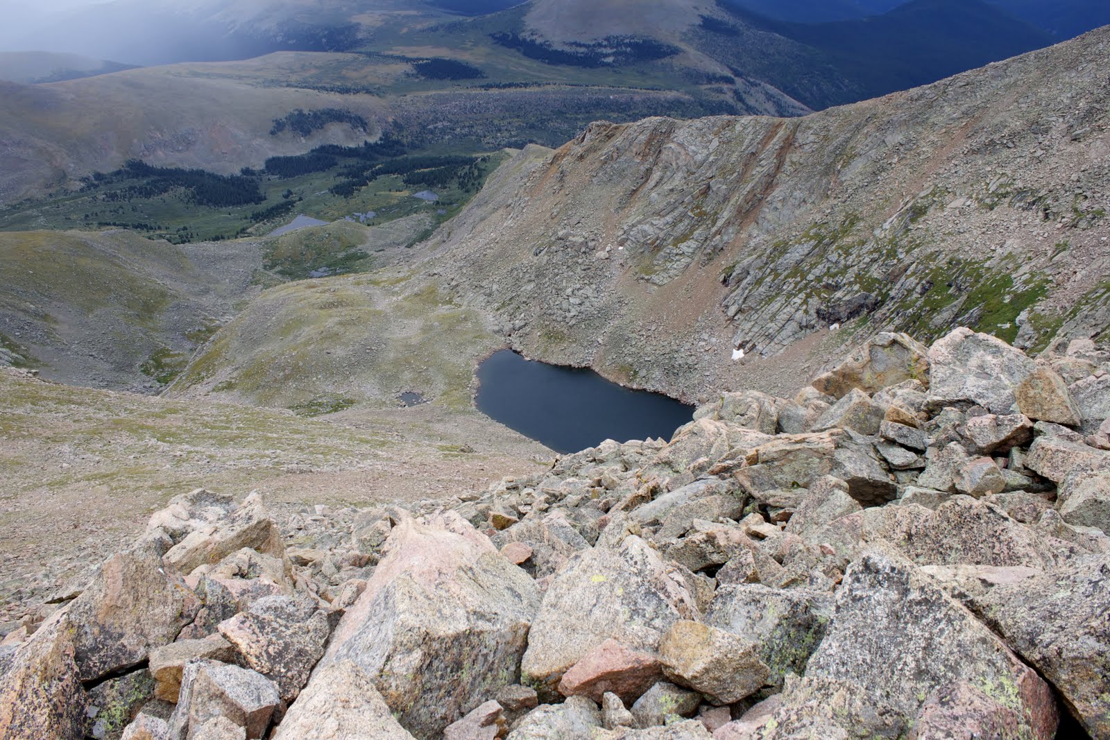
The trail leading away from the work site and up the peak was quite steep, like walking up stone stairs.
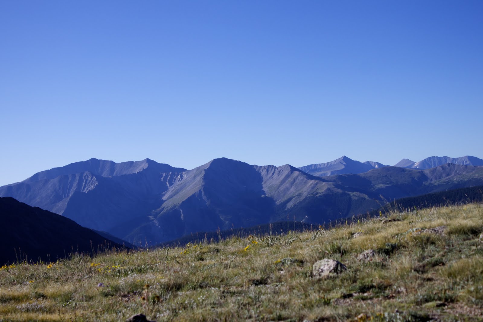
And the higher I hiked, the more amazing the scenery.

 Aside from my failed attempt on Quandary Peak, I had not attempted another 14er. Mount Yale is quite steep, and culminates in a scramble to the summit.
On my way up this final scramble, I lost the trail as some of cairns had been toppled... So, I scrambled up and over the top, to the next visible cairn.
I reached the summit of Yale around 2pm on August 6, 2011 at 14,196ft.

Shortly after reaching the summit, I noticed a cloud moving quickly from the valley to the summit of the peak. I expected to be rained on, however I was pelted with small pellets of ice instead.
I hurried down the peak, and made it back to camp by 4pm, exhausted but happy.

The next morning I awoke, packed my gear, and set out for the cars. I made it down to my car by 7:30, and made a straight line for the nearest coffee shop.

This trip was an amazing experience, and I do plan on volunteering for more stewardship projects in the future. If anyone reading this lives in Colorado consider donating some of your time to stewardship!
http://www.cmc.org/stewardship/