Friday, December 30, 2011

Debacle on Beaver Brook Trail!


My friend Tiffany and I decided to hike the Beaver Brook Trail, one way. That meant placing one car at either end of the trail. The trail is fabled to have anywhere between 7 and 12 miles, however mostly I saw 8.9 miles in the trail guides. I didn't exactly tell Tiffany it was that long... Not until we were about two miles in... She had a feeling I had fibbed.
Tiffany

Either way the weather was amazing, 55 degrees and sunny! There wasn't enough snow to warrant snowshoes., so we wore traction devices. We brought both of our dogs, and let them run free, there was no one on the trail all day, just the four of us!

Looking northwest from the trail.
Interesting snow formation 6 miles down the trail.


I was given the chance to check out my new Soto micro regulator stove, which was amazing!!

Somewhere near mile six there was split in the trail, and we made the unwise decision of taking the most traveled trail... Which was the wrong one... We ended up one highway exit up from where we left the other car, which would have been an additional 3.6 miles... Making the 8 mile trip almost 12. Tiffany called a friend to come pick us up and drive us to the second car.


A lonely elk in the midst of a heard of Bison , looking for his friends. 

I should have come prepared with a trail map, which I usually would... I felt like a dope! However i've learned my lesson...

Afterwards we drown our stupidity next to a roaring fire, with a nice pint, at Golden City Brewing.


Wednesday, December 21, 2011

Climbing Snow and falling through snow, at St. Mary's Glacier

Snow climbing is one of my favorite things to do, and I was at St. Mary's Glacier four days earlier with a friend of mine, where I saw the loveliest, hard-packed, snow in a small couloir.
Lefthand chute.


The one of the lefthand side of this photo, it required crossing the lake, climbing the chute, then up and over the summit of Point 11,716, then glissaded down the glacier back to the lake. I decided this was a trip that I really wanted to do, so I invited one of my friends who is interested in mountaineering to come with me. I figured it was a good training climb for someone who had never used crampons/axe for climbing snow! 

We arrived at the trailhead at 7:00 am, gathered gear, and began the hike up to St. Mary's Lake. The lake was frozen solid, and we were able to cross easily after we strapped on our crampons. There was a brief lesson on crampon/axe technique, and we began the climb. 

Looking down the chute!
 The weather was gorgeous, and the snow was hard in most spot, however there were some wind blown areas with a hard crust, and tons of powder below. Once above the chute, the view was amazing, you could see clear over the glacier, and all the small people walking down below.
Sitting above the mouth!

The trek above the chute.
Looking across to the glacier.
Once we made it up over the summit, we had to cross a large snow drift area, I made it and settled on an exposed rock only to turn around and see my friend up to his waist in snow. I didn't help him out.
Stepped on a tree and fell into a drift. Haha. 
The glissade down was amazingly fast, and super lumpy... I had a few lovely bruises from that...but climbed up again to do it a second time. It was fun!

All in all the trip was a success, and I go to complete my snow climb that I wanted to! :)

Friday, December 16, 2011

Torn-up by Grizzly Peak

So a friend of mine mentioned that there was a trip going up Grizzly Peak via the standard route. He knew this was on my short list for winter ascents, so despite his warnings about the groups fitness level...I signed up for the trip.

I arrived at the approved meeting place, the four of us piled into one of our cars and made our way to Loveland Pass. It was a beautiful morning, and the sun had barely begun to peak over the ridgeline. I have gone hiking up in this area numerous times with no trouble, however the other three members of our hiking party were practically running up the slope!

Grizzly Peak from Loveland Pass.

They stopped maybe twice the entire trip to drink water/eat... I usually make regular stops so that I am able to stay hydrated and nourish my body. When I am out hiking, I've realized that my body just burns through calories, and I need to continually eat in order to keep my energy up! I decided not to let that ruin my trip however, I made an attempt to keep them in sight.

Once we climbed the first incline we headed towards an area called "Cupid"13,117ft, a small hump between Loveland Pass and the epic lines of Grizzly Peak. The long ridge line had the beginnings of a lovely cornice!
Right- Grizzly, Left Torreys and Greys.
Then we continued down over the side of "Cupid", over the jagged ridge line, to the final push up the ridge. The final ridge, was very steep, and I was already having problems with the altitude-- my mountaineering axe was a necessity. I was worried I wouldn't make it to the summit, however once of the trip leaders encouraged me. I slowly, but steadily made my way up the sharp ridge, to the summit.

The view was amazing on all sides, and Torreys and Greys felt so close!!
Torreys and Greys from the summit of Grizzly Peak.

I made it!!! Grizzly Peak 13,427 ft.

I was able to make the summit, however upon descent, I ended up having altitude sickness- slightly dizzy, nauseous, and unable to catch my breath. Granted it wasn't severe altitude issues- but it certainly made it difficult for me to complete the trek back to the car.

I've learned that drinking water is imperative, and so is eating. I also realized that I need to train a lot more before I go hiking with the likes of those guys again...but more training couldn't hurt. So that is my mission.


Sunday, December 11, 2011

Escalating Englemann Peak, the unfinished saga or I was not in the mood.

The day began early, before the sun rose above the peaks. The frigid cold froze hair, and eyelashes. Englemann peak(13,362ft) lies up a steep road, and then off trail, in to the thick woods.

The sun had barely crested the horizon as we began up a trail with extreme avalanche danger...

Or so claimed the sign, there wasn't nearly enough snow to warrant an avalanche.

The snow was beautifully crystalized and fluffy, and stomping through the high drifts deeper into the woods was my favorite part of the trip. It was so cold that my hair, eyelashes, and balaclava were frozen! As the sun began to crest the peaks, it began to warm up, and the wind began to blow.

Once above tree line we stashed our snowshoes, and there was an AMAZING view of the surrounding peaks!

Parnassus Peak


Section of the Gore Range, the jagged peak in the center is "the Citadel", with Pettingell Peak on the right.
I usually do not have great difficulty with altitude, however I had already lost energy by the time we reached higher 12s. I made the decision not to summit, which is a difficult one to make, however I'd rather not have difficulties later in the trip. I sat down with another member of our party who had been up there multiple times, and had a cup of warm coffee, discussing geography.

One of the greatest scenes from our trip was the rest of the group descending from the summit-- everyone was wearing a different color, it was as if a rainbow was haphazardly climbing toward us.

 Though I didn't summit, it was a lovely trip, and I met some nice people! I also realized that sometimes I have limitations, just because altitude hasn't affected me on MOST of my trips, doesn't mean that it won't get me sometimes. I was still able to enjoy the beautiful scenery, and stomp around in the snow....which is really the point! :)

My mouth looks frosty!


Saturday, November 26, 2011

Solving the Quandary...Peak-- My Thanksgiving at 14,264 ft.

Thanksgiving is a time spent with family and friends, turkey, homemade pies, especially pumpkin...-- but not this year, not for me. My family lives back in New England, and my family out here didn't invite me to thanksgiving this year...so I created my own holiday! I call it "Peaks-giving",  there is a
"feast" and a "gathering. " The "feast" consisted of a turkey sandwich, and two Spiced Pumpkin Pie Clif Bars. The "gathering", four other individuals from the Colorado Mountain Club. The peak, Quandary Peak...the very same peak I attempted in June and was unable to complete.
My "Gathering".

We selected the East Ridge route which is around 6.5 miles round trip with 3400 ft. of elevation gain. After last weekend's failed summit attempt on Audubon I had decided that this week would be different, even if there were 5 ft of snow, I would push myself harder to make the summit. I took it as a personal challenge... however once we arrived at the trailhead I was a bit disappointed...there was barely any snow, maybe one snowfield...on the way down.

Once above tree line the wind began to blow, the sun was high in the sky by the time we began to hike up the second shoulder of the ridge.
To the right.

To the left.

Since the last time I attempted to climb this peak, I've hike two other 14ers, and spent much of my time in the back country.  Before I was dragging, and stopping every 10th of a mile to breath, now I was able to bound up sections of the ridge. Every time I go on one of my adventures, I come back incredibly sore, but much stronger for my next trip.

This time, I summited Quandary Peak at 14,264ft, and was alone on the summit. I've never been on a summit without at least 5-10 other hiking parties.


Standing on the Summit of Quandary Peak, 14,264.


We sat down and ate our "feast" together, amongst the radiant peaks of the Rocky Mountains, only the sound of the wind and ourselves. The hike down took far less time than the hike up, however at one point we lost the trail and slogged through one of the snow fields. After a day of warm-ish weather, the snow was loose, and I post-holed above my knee down the slope. Aside from the post-holing, the rest of the hike was uneventful.

Despite the lack of traditional thanksgiving festivities, it was a truly fantastic way to spend my holiday, on the side of a Peak.


Thursday, November 24, 2011

A long slog in the deep deep snow. Abominable Audubon Attempt.

Mt. Audubon looms over the righthand side of Brainard Lake in the Indian Peaks Wilderness, and this was our presumed destination. The four of us drove up to the Indian Peak Wilderness "winter"  parking lot- the road to Brainard Lake is closed in the winter.

We started hiking around 8am, up the road towards the lake. The cool crisp air, thought normally pleasant, was blowing steadily, and increased with elevation. 


Windswept highway.
By the time we made it to the trailhead the snow had gone from a few inches to nearly five feet deep, it didn't help that nobody had been up there that day and we broke trail the whole time.
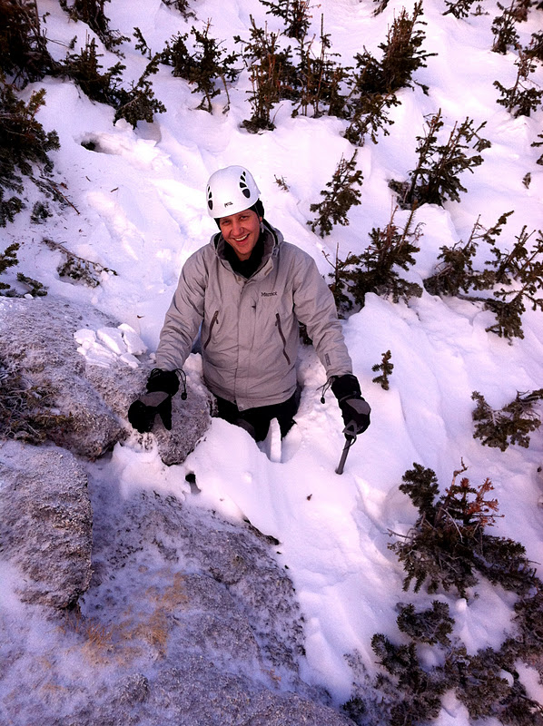
The fellas.
The trouble with winter is that if a trail has not been marked for winter use, it is very difficult to find the trail, and often you are making your own trail. We wove in and out of the woods, sometimes over and under trees while Martie, true to form,

kept a sharp eye out for avalanche danger.
Deep snow!

Stomping through the snow.
Breaking trail, at times could be rather difficult-- attempting to climb up and over snow drifts, however the weather could not have been more lovely!
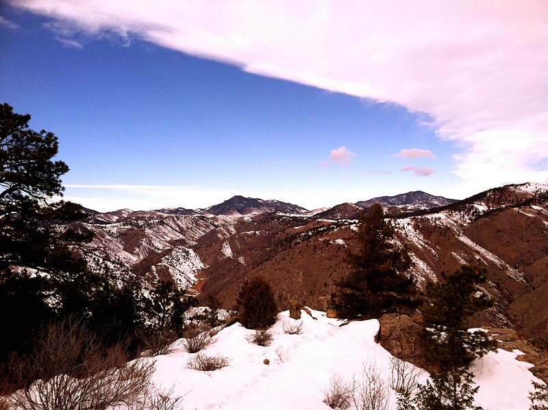
Audubon.

Talus field.
I'm not sure how I was able to get Martie to agree to climbing a steep snow covered Talus field, but it appeared to be the safest route, much better than the avalanche chutes littering the side of the ridge. I had to remove my snowshoes before leading up the steep slope, careful not to kick any rocks loose. It is mildly awkward when you think your foot is on a rock, and you put weight on it....then it breaks through to a 3 foot hole. Zig-zagging up the slope, the scenery became more breathtaking, and looking back at my cohorts was fun!
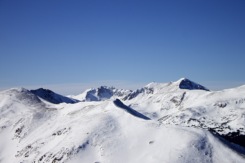
The view ahead!

The view below!

Once above the rock slope, we strapped on our snowshoes and decided to climb above treeline, the snow had a beautiful carved appearance and the wind was whipping at my face mask. With Goggles and face masks we all looked like underwater explorers or like we had gas masks on!


Once above treeline, the group decided to climb to the shoulder slightly above treeline as our "summit" for the day. We removed our snowshoes and placed large rocks on them so they wouldn't blow away, you know the wind is strong when metal snowshoes might blow away. The wind was so strong, I was nearly blown over, a few times I had to brace myself against the wind. My vision was obscured by the crystalized snow enveloping around my body, the sound was deafening, I was unable to hear my three cohorts! Here are two short videos one of my party members took. In the first video, I am bracing myself against the wind


 There were times when I lost sight of the person twenty feet away, they would just vanish into a sea of  snow.


To the left.


To the right.


Mt. Audubon was so close, yet very far away, we had another 1.6 miles to hike in order to reach the summit, and another 1700 ft. of elevation gain and there was a storm, or something blowing in from over the peaks.
Me, Struggling against the wind.

We only sat at our summit for a few moments before we headed back down the peak to our snowshoes, and found an easier route down to the basin. 

Last view of Audubon before we descended.

Most of the climb down was very uneventful, however we were crossing over Avalanche chutes, and it had to be done at a time...just in case one of us was buried. There were thousands of small snowballs knocked loose by my snowshoes, plummeting towards the trees below. I kept imagining the snow fracturing right below my snowshoes and dragging me down into a crashing wave of snow, however there wasn't a high risk of avalanche.

Back to civilization. 


We arrived at the lake near sunset, and I looked west to see an unusual fiery glow from behind the snow shrouded peaks.

Once beyond the lake, we headed back to the car, arriving around 5:00pm. We were out there all day, and only hiked 9.8 Miles, with a 2,000 ft elevation gain. 
Here is the route from today courtesy of one of my cohorts!
Every time I head out into the back country, I learn something new about the landscape, how to treat certain situations, and what I can handle. 

Below are shots of the dream team!

Mike
Will


Martie

Me!